Wanaka: wandering around in Wanaka…

In case I haven’t already mentioned, let me just repeat that Wanaka is probably my favourite place in New Zealand. Perched on the shores of Lake Wanaka, it is a very scenic location, and has just the right mix of facilities without being quite the full-on tourist town as is Queenstown, where I’m heading tomorrow.

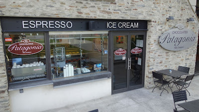
Last night on the way back from dinner, I spotted the Patagonia Chocolate shop, which I thought might be a sister shop to the one I visited in Queenstown about 4 years ago. So after a lazy lie-in this morning, I wandered down for breakfast – chocolate croissants, and a hot chocolate drink sprinkled with ginger. But I couldn’t stop at one, and had to have another.

After getting some photos along the lake shore I visited the local bicycle shop and arranged to have the rear hub on my bike adjusted. The bearings cones were a little loose, and the one tool I didn’t bring is a cone spanner. 

I dropped the rear wheel back at the shop, and restocked my camp food supplies from the local fishing and camping store, then spent some leisure time reading the paper and drinking coffee before heading back to my laundry chores, and later, to collect my wheel from there bike shop. 

When the bike shop owner  learned of my plan to cross the Crown Range tomorrow, he let me know that a stage of the Tour of Southland cycle race will pass along the road, likely whilst I am still on it, and that there will be a rolling road closure. Suits me, I won’t mind spectating on a bike race for an hour or so.

So that has been my day off in Wanaka – shortly I’ll head out and pick a likely place for dinner, and then it’ll be back to my room to pack for an early start tomorrow. 

Despite feeling very heavy and sluggish when I arrived last night, my legs felt quite strong today, ready for another climbing session tomorrow. At least it will be a much shorter day.

That's right Boofle - there are three, and none are for you...

Chocolate lovers - look away NOW...

A novel breakfast spot...

Panaorama of Roy's Bay - in the distance the Treble Cone ski fields still have some snow cover ...

The jewel: crossing the Crown Range…

Distance: 71.6km Ride Time: 6:37 hours.

Wanaka is on the shores of a lake, and there is only one way out, and that is up. So my legs got another early wakeup call this morning. The weather looked a little doubtful as I set off – a few dark clouds loomed ahead, and the wind had started to pick up. Once over the first climb the route turned south along the broad and beautiful Cardrona Valley. Before long a shower began to fall, and I wore my rain jacket briefly, before the sky cleared and the sun returned.

The road rose almost imperceptibly until after 25 kms, I reached the Cardrona Hotel. I stopped to admire the historic building, and enjoy a bowl of soup and a cappuccino before continuing.

By now the valley was narrowing dramatically, and the first climbing began. The road wound its way along the valley floor, crossing the Cardrona River many times. Still the going wasn’t too difficult, but I had been warned that the real climbing only started after the “unnamed” bridge.

And how true this advice was – after crossing the bridge, and with only around 3 km expected before reaching the pass, suddenly I was struggling on a 10% grade, and looking ahead I could see the climb becoming unrelenting steeper. It was too much for my legs, and when the grade hit 15% I could ride no further, and walked for some distance, until approaching the pass the grade eased a little and I could remount to finish the climb.

After a brief photo stop on the pass, I began the descent, and soon encountered a rider participating in the Tour of Southland cycle race.  The finish was a little further down the climb, but he had continued to warm down his legs. He joined me on the decent, and we chatted about the race as we went down.

At the road closure, there was a long line of traffic banked up, but we rode down to the front of the queue and were allowed to continue through the closure.  A little further down the road the stage had just finished, and there was a scramble of bikes, riders, crew and vehicles, even helicopters. I crossed the finish line and inquired about the awarding of the KOM jersey, as I was the only rider to actually cross the pass, and I got a sympathetic laugh but no jersey.

The race ambulance was just leaving, and I enjoyed a fast descent chasing it down the remaining series of switchbacks to the valley floor. It was probably the fastest I’ve ever descended on a loaded touring bike, but it was a lot of fun and at least first aid was at hand if anything went wrong.

At the valley floor there was only around 12 kms to go to Queenstown, but by now the wind had picked up and changed direction, so again the last few kms were the hardest. Eventually I reached the town centre and visited the iSite looking for somewhere nearby to stay. 

Like tourist towns everywhere, nothing in Queenstown is cheap. I settled on a studio at the holiday park, but it’s by far the most expensive accommodation I have used on this tour. Never mind, the next two days will be freedom camping.

Tour of Southland? Wait - that's me. Gee thanks, but really there was no need to close the road...


Boofle took a liking to the car...

This lady decided I was "Superman" and insisted on a photo...

Away in the distance, Queenstown sits on the shore of Lake Wakatipu...

Queenstown: tourist town...

This morning I headed down to the lakeside to book my passage on the steamship TSS Earnslaw, across the lake to Walter Peak Station, from where I’ll the start the next stage of my tour, to Mavora Lakes. On the way I noticed the Patagonia Chocolate shop, and returned there for another chocolatey breakfast, before taking a stroll around the shopping precinct. At the supermarket, I picked up food supplies for the next two days, when I’ll be away from any services.

Then it was back to my room to do some chores and update my journal.

TSS Earnslaw is getting up steam...

And leaving the dock...

Boofle doesn't like boats...

Lake Wakitipu panorama...

Snow, more snow: sometimes you should just stay in bed...

Distance: 53.5km. Ride Time: 5:45 hours.

When I looked out the window early this morning, it was raining outside, and quite likely it was snowing on the Remarkables, which were mostly obscured by cloud, but I could see in places a fresh covering a white powder. So, no cycling today I thought, and went back to bed. As it turned out, I should have trusted my first instinct, but when I looked out again the sky had cleared and the sun was shining. So with time in hand to make the 10am sailing of the Earnslaw, I packed quickly and headed off to find breakfast.

At the steamer wharf, the smell of coal smoke hung in the air. My bike was quickly loaded via the wide cargo gangway. There were already quite a few bikes aboard, and I discovered they were part of a guided group of day riders who would be taking the same route as myself, but with vehicle support. To my dismay, the guide informed me that that the road had recently been graded, which is rarely a good thing for cyclists. A cool wind was blowing, so I wore my rain jacket for the crossing, but I would end up wearing it all day.

The Earnslaw will be of great interest to anyone interested in steam engines. Two triple expansion engines power the ship, the steam is generated by coal fired boilers. These are rarely seen now outside static museum displays, let alone in a working vessel. The engine room can be viewed from the promenade deck, and you can go down to the upper level of the engine room for a closer look.

The short cruise across the lake was a pleasant and very scenic. I waited to take a photo of the steamer departing, and then set off along the freshly graded road, which skirted the lake shore. Overnight rain had settled the surface, but it was still loose and soft in places. After 10 kms, I came upon the grader parked by the roadside and the road surface was mostly good after.

Soon the road turned away from the lake and headed up the Von River valley. Further up the valley, dark clouds gathered ominously, and shortly it began to snow. This was just the first of many snow showers, which kept me shivering all day. And then I encountered the first of two fast flowing fords. I had to remove my shoes and brave the icy water barefoot. It was quite difficult to cross in the knee-deep water, and I had to wrestle the bike across in the fast current. Luckily my Ortlieb panniers were waterproof as claimed and none of my gear got wet.

After 25 kms I came to Von Hill, rarely mentioned in the journals I’ve read, but every bit as difficult as any of the passes I have crossed on the tour. Especially when there is a chill wind blowing and snow falling. I think I walked most of the way up, and at the top was confronted with a broad flat valley and km after km of rolling road.

And more snows storms, rolling up the valley. It’s at times like this when I question my choices, but in good weather it would probably have been a pleasant ride.

Soon after I came to the second ford, even deeper and wider to than the first, and again I wrestled the bike across in my bare feet. But surprisingly, my legs still felt OK, and then the road started heading downhill, and I was able to make good progress. Eventually at around 7pm I reached the turnoff into the lakes, and soon found the camping grounds. Quickly putting up the tent I crawled into my sleeping bag trying to warm up, and that is where I stayed. It took a long time to get warm, and with sandflies swarming around the tent door I didn’t want to bother with hot food, and made do with what I could find in my tucker bag. 

The plan is to spend tomorrow here and go fishing, but unless this cold southerly stops blowing and the temperature rises. I doubt there’ll be much point.


The weather early this morning - should have stayed in bed...

But an hour later, it looked like this - sucker...

The bits that hiss, wheeze and thump...

Boofle's not letiing the lifeboat out of sight...

Walter Peak wharf...

Hmmmm, somebody is gonna get wet feet here...

Can someone say a prayer to the snow gods - I've had enough...


Lakeside: keeping out of the cold...

It was very cold overnight, and the frost was heavy. Once again I was glad to have a four-season tent.  My campsite is in a very sheltered position, and didn’t catch any sun until quite late. I will have move to a sunnier position to get the tent dried and packed in good time tomorrow morning.

The chill southerly wind is still blowing down from the snow-covered tops, but at least the sun is out today. Hopefully by tomorrow the wind will have changed and it’ll be a good day to cycle.

Mavora Lakes would, but for the dreaded sandfly, be a lovely place to camp in warmer weather. But while this cold wind keeps blowing the only thing I can do it stay in a sheltered spot and enjoy the sun.

I took my fishing rod out and tried my luck, once again in vain. The locals seem to think it is just too cold for the fish to have become active, or at least for the insects on which they feed to have bred up in the numbers needed to get them going.

A little later the ranger dropped in to check my registration. He pointed out a spot where he had recently seen trout, not more than 200 metres from where I had been fishing, but I was more inclined to stay out of the wind than to brave the bloody sandflies for another try.

Just waiting for a trout to swim past my table...

At the head of the lake, the Greenstone and Routeburn tracks pass...

See if anything will dry...

Concentration: riding on marbles...

Distance 69.2 km. Ride Time: 4:48 hours. 

According to Mavora lakes ranger Tim, today the weather would clear, and the winds would shift to southeasterly. So I was not in the least surprised to wake this morning to the sound of rain on my tent. Eventually it stopped, and I decided to pack up and get going whatever the weather, rather than hang around the lakes for another day.

With the late start it was 10am before I got on the road, but I was optimistic of reaching Te Anau by mid-afternoon.

The road south from the lakes was covered with loose gravel, with only a narrow wheel track relatively clear, but the trend was downhill, and the wind was definitely a southeasterly – more help than a hindrance. Looking down the valley there where some ominous grey clouds gathered over the tops, but I managed to outrun all but a few brief wispy showers.

So I made pretty good time for all but the last few kms of the gravel section, where a grader was operating, making the final section very difficult – it was like riding on marbles.

Once the sealed road was reached I enjoyed long sections of downhill running and with the assistance of the wind covered the remaining 30 kms to Te Anau by 3:30pm.

I’ve planned to take a cruise on Doubtful Sound tomorrow, so went straight to the booking office, then checked in at one of the holiday parks. After a hot shower, early dinner and laundry chores done I’ll be off to bed.


A last look up the valley to Mavora Lakes...

Tourist time: to Doubtful Sound...

-->
To celebrate my bike and I surviving New Zealand’s back roads, today I played tourist, taking an excursion to Doubtful Sound. I could have visited Milford Sound, but I’ve been there previously, so it seemed a good idea this time to visit the other.

The day started with a bus trip to Manapouri, then a ferry ride across Lake Manapouri to West Arm, where another coach took me over the Wilmot Pass to Doubtful Sound, all before boarding the cruise boat. The trip took in some stunning scenery, and it was a perfect clear, calm and sunny day for the first time in a week. I hoping it will stay that way for a few more days while I make my way down to Invercargill.

Lake Te Anau was placid after the winds of the last few days...

From Wilmot Pass, Doubtful Sound awaits...


That is the entrance, away in the distance...

Hmmmm, now that is a bach...

Looking up towards the head of the fiord...

It’s a long way: to Tuatapere…

-->

Distance: 106 kms. Ride Time: 7:38 hrs.

After a cold night, the morning was grey and cloudy.  The run of good weather I’ve been enjoying looked to be over. After breakfast at the local bakery, I set out towards Manapouri. The wind, though light, was in my favour, and the road trended downwards, so I covered the short distance quickly and enjoyed a second breakfast before embarking on the longer distance to Tuatapere.

The favourable running continued and I made good progress until I reached Jericho Hill, where the grade suddenly pitched upwards and slowed my progress considerably. Soon the early cloud burned away and I was able to strip off my rain jacket for the first time in a week.

By mid-afternoon the wind had changed direction, and I had to push hard across kilometer after kilometer of dead straight road down a broad valley. Eventually I reached Clifden where a I paused to view the historic suspension Bridge across the Waiau River, then pushed on to Tuatapere, where I took a backpacker room, and after dinner at the pub and an interesting conversation with some Hump Ridge trampers, I was asleep before dark

Lake Te Anau...

OK Boofle, maybe you will have to help me with this...

Clifden's historic suspension bridge

Almost at the bottom: Invercargill...

Distance: 88 kms. Ride Time: 6:33 hours.

Today’s distance is slightly shorter than yesterday, but with a little fatigue remaining in my legs, I expected it to be just as hard. So I rose early, breakfasted and got on the road. Once again the wind was in my favour, and I had soon reached the coast, were the sea was perhaps unusually placid.

The road undulated along the coast through farmlands. At least the scenery was a little more varied than yesterday, and there were a few small settlements along the way. At Colac Bay the pub looked inviting so I stopped for lunch, and was served the biggest burger I’ve ever seen.

Soon after I passed through Riverton where I stopped briefly to buy a sports drink. The shopkeeper raised a wry smile when he remarked that it was a hot day for cycling, as I stood before him wearing gilet, arm and leg warmers with my cycling kit.

After a short break I set out on the final 30 kms leg to Invercargill. This is a very busy stretch of road, and particularly uninviting was the regular smell of farm effluent carried on the wind.  By now I was feeling quite saddle sore after two long days on the road, and the final kms were distinctly uncomfortable, but I arrived in Invercargill at about 4:30pm and booked in to a central backpacker.

The Speights Ale House is right next door, so after a quick shower I enjoyed the roast of the day – a nice change from pub meals served with “chuppies”.

Tomorrow I had planned a short return dash to Bluff, just the bike without all the panniers and gear. But the weather may intervene yet again as rain is forecast. We shall see.

Looking back at the Waiau River mouth...


Bluffed: not by Bluff…

Distance 60 kms. Ride Time: 3:53 hours.

Despite being the end of SH1, Stirling Point at Bluff is not quite New Zealand’s most southerly mainland location. That distinction belongs to Slope Point, some distance away to the east.

Bluff is a seaport, grimly industrial, with an air of neglect and decline. Because of the location at the end of the road, it’s one of those places that you feel you may regret not visiting, and then once you do, wonder why you bothered.

There's not much more to say about Bluff. Despite the forecast of rain the day dawned clear and warm, but became overcast while I dallied over my preparations. I stripped everything but bar bag from the bike, and fastened my rain gear on the rack. It made for an easier ride, and I was back in Invercargill just after lunch.

Of much greater interest than Bluff, was my visit to E Hayes & Sons, the local hardware store, which houses in amongst the hardware an impressive collection of vintage motorcycles including Burt Munro’s 1922 Indian Scout (World's Fastest Indian), speedway and race bikes, some vintage and classic cars, and odd bits of farm machinery.

I wandered around the displays for an hour or so, and there were quite a few others like me who were obviously only in the store to view the displays. Another visitor told me he had seen the two Vauxhall cars used in the movie at the transport museum in Wanaka, which because it is bit out of the town centre, I didn't visit.

Stirling Point, Bluff - end of SH1...

Bert Munro's original 1922 Indian Scout...

The world's fastest Indian...

Boofle took a fancy to the movie replica...
Scene straight from the movie - Burt's homemade pistons and rods...
I could have used one of these on some of the passes I've crossed...

There is something very special about an Arial Square Four - here's a pair of them,
with a water-cooled Velocette in the background

How rare is this...

This Morris Commercial has been beautifully restored...


Cold, wet, windy: surely not?

Distance: 61 kms. Ride Time: 4:22 hours.

When I arrived in Invercargill I discovered yet another system of colds fronts was forecast expected to arrive over the next few days. Sure enough, yesterday morning I awoke to wet and soggy conditions, and decided to delay my departure by a day.  But really, I was just delaying the inevitable, as the fronts were almost certain to arrive sometime whilst I was on the road.

So I set out this morning in calm and overcast conditions, with a slight breeze assisting and the road gently rolling, and I was able to make good time.

As the morning progressed the clouds became darker and darker. The first shower arrived just as I encountered a pair of German cycle tourists I’d first met approaching Queenstown. They had taken the Otago Rail Trail across to the east coast and were approaching Invercargill from the opposite direction.

Soon after I reached the Titiroa River, near Fortrose.  It’s the whitebait season, and there were many whitebaiters with stands and nets along the river. I should have stopped for a photo, but the cold front arrived about the same time, with driving rain and howling cold winds.

Pushing the last few kms through the wind, I arrived at the hamlet of Fortrose just after midday, and stopped at the one and only café.  It was just after midday so I decided to stop for lunch and wait to see if the front would pass quickly.

The café was offering whitebait on the menu. It’s undoubtedly a delicacy to many Kiwis’, and some go to great lengths and endure much to catch them, so I decided it was time I tried them for myself to find out what all the fuss is about. I ordered a whitebait omelette, which tasted – like an omelette. I expected whitebait to have a fishy taste but couldn’t detect any fish flavour at all.

After a languid lunch break conditions had not improved, but I continued anyway to see how far I would get. It soon became obvious that in the battle against the wind I would be the loser. So at Tokanui  around mid-afternoon I decided to call it a day. Tomorrow, if the conditions improve, I will have easy and fairly short ride down to Curio Bay, which give me a little more time to have a look around.

Curiosities: at Curio Bay…

Distance: 30 kms. Riding Time: 2:45 hours.

The wind had dropped, but a steady drizzle was falling when I woke this morning, so I took my time over my oats and tea. By the time I was ready to go, the sun had begun to appear, and with only a short distance to cover, I set off at a leisurely pace, listening to an audiobook as I went (French Revolutions by Tim Moore). 

Soon I reached Niagara Falls café, a truly charming place with a comprehensive menu, in the middle of nowhere. Deciding on a second breakfast, I was convinced by the waiter to try the locally smoked salmon, and it proved truly delicious. In the background, the local ladies musical group entertained by playing their ukuleles and banjos.

From Niagara it was but a few kms to Waikawa and thence on to Curio Bay – a beautiful curving beach. I quickly settled into a backpacker room, then headed for the beach, and spent a couple of pleasant hours soaking up some sun.

Curio Bay is so named for the rare petrified forest on it’s shore, and almost as rare, the yellow-eyed penguins and Hector dolphins. So in the early evening I ventured down and saw the petrified forest and also some penguins. I couldn’t see any dolphins, but the Hectors are quite small at less than a metre, and are hard to spot.

An English visitor staying at the backpacker shared a few beers and a long and interesting chat before I finally called an end to an almost perfect day.

Approaching Curio Bay...

Porpoise Bay panorama...

Boofle didn't want wet feet...

Petrified tree stump...

Pertified logs and stumps...

Smile birdie...

Boofle was fascinated...

Catlins: What about all those hills...

Distance: 71 kms. Ride Time: 6:36 hours.

The plan for today was to ride to Owaka, buy supplies for dinner and then continue for a few more kms to a pleasant holiday camp at Pounawea.  What I hadn’t realized is that this part of the route is very hilly, in fact it’s more than that, there are a least four serious climbs along the way. My legs by now are not much troubled by hills, but they do slow progress significantly.

I set out fairly early without eating; planning a return to the delightful Niagara Falls café, but when I arrived at around 9 am it wasn’t open.  So I elected to continue on to the McCleans Falls café, about 20 kms away. But within a few kms I found myself grinding up the first steep climb, and after a rapid descent, ground my way up a second steep climb to reach the café. This is another very pleasant spot, and I lingered long enough for a combined breakfast and lunch.

Approaching Papatowai I came to the third (Florence) hill, with a stunning outlook over the coast, and when I stopped for a coffee was informed that the biggest hill was still to come. And sure enough, soon after leaving Papatowai the road began to rise, and continued on relentlessly for km after a km.  Eventually after a series of false summits I finally reached the top and started a white-knuckle descent.

The final few kms in to Owaka were fairly flat, but by now my legs had had enough, and I decided to go no further. I took a room at the pub and revived with a couple of pints and a steak. 

The view from Florence Hill...

Enough hills: Milton it is...

Distance: 59 kms. Ride Time: 4:42 hours.

Once again I awoke to the sound of rain falling, but quickly packed up and went looking for breakfast. The only store open in Owaka at 8 am was the 4 Square supermarket, so I was forced to resort to pastries and (undrinkable) vending machine coffee.

Leaving Owaka in light rain and wet weather gear I was cold, but then the road began to rise steeply and I was soon steaming hot. Once over Tunnel Hill the road gradually leveled out, and I reached Balclutha by midday, stopping for lunch.

Leaving Balclutha, for the first time I joined SH1, which immediately began a series of nasty roller coaster undulations lasting for almost 10 kms. I was alternately grinding uphill in low gear then plunging downward, buffeted by the wind blast of innumerable heavy vehicles as they overtook me.

On one of these wild descents, my rack bag came adrift and tumbled to the road.  Retrieving it, I realized that somewhere I had lost my fishing rod, but there was no way I would ride back along the roller coaster in the hope of finding it intact.

I called it quits at Milton. With only 60 kms remaining to Dunedin tomorrow, I was happy enough to stop there.